Transforming the story of two Sussex villages
A recent series of excavations across Burpham and Wepham in West Sussex has revealed new – and sometimes surprising – insights into their origins and evolution. James Sainsbury reports.
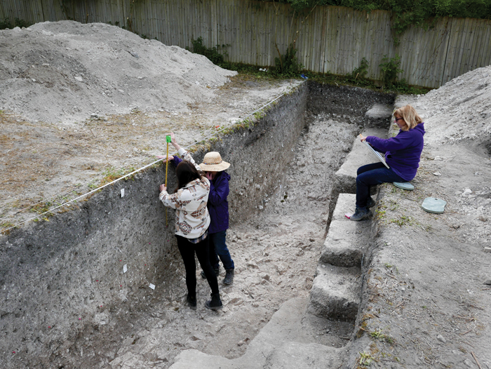
Located close to Arundel in of Burpham and Wepham have classic Anglo-Saxon names – but their residents recently helped to uncover a story stretching far before and beyond the early medieval period. In 2024 and 2025, Worthing Museum partnered with Worthing Archaeological Society (WAS) and local volunteers to carry out a major series of excavations within Burpham parish, digging more than 30 test-pits in private gardens and opening five large trenches over the enigmatic defensive ditch of the promontory fort that gives Burpham its name. These combined efforts recovered 17,000 artefacts, helping to tell a new history of how both villages developed – though the earliest finds from the Burpham Big Dig date to a period long before humans called this area home. These were a series of fossils – sea urchins and sponges – from the Cretaceous chalk on which the Downland parish sits. The presence of these marine species highlights how much the landscape has changed since they lived 70 million years ago – and, in fact, it is likely that at least some of the fossils may have been found higher up on the Downs and brought back by curious locals before they were lost in garden plots, providing a tangible link between the area’s distant and much more recent past.
The oldest human-made finds, meanwhile, were flint tools, including tiny microliths, from the Mesolithic period. They speak of early hunter-gatherers moving through the riverine landscape around Burpham, hunting game and fowl and probably (though we have no direct evidence from the Big Dig) using traps to catch fish and eels in the Arun. The largest number of worked flints, though, dates to the Neolithic, demonstrating that the earliest farmers in Britain were present here c.6,000 years ago, clearing woodland for their livestock to graze. A particularly fine find from the parish is a pristine Neolithic flaked axe, which was discovered during a field-walking survey in 2025. Its raw material was almost certainly extracted from the chalk at one of the substantial flint-mining complexes that are known to have operated on the Downs above Worthing, just 2 miles (3km) to the east (see CA 389).
RETHINKING RAMPARTS
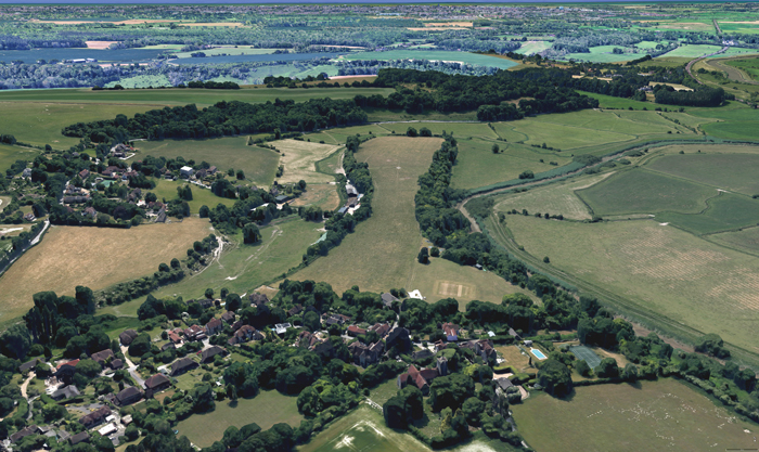
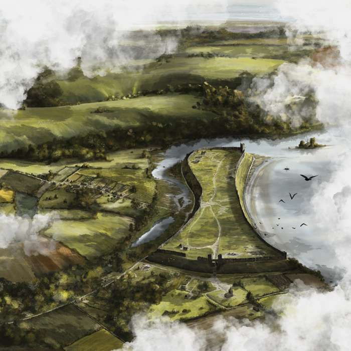
Perhaps the project’s most surprising insights relate to the medieval period, and to the large promontory fort, or burh, from which Burpham takes its name (meaning ‘settlement by the fort’). There have been suggestions that the earthworks have Iron Age origins, though there was a complete lack of pottery, or other finds, of this period during the Big Dig. We do, at least, know that the fort was in existence by c.AD 900, as it is recorded in the Burghal Hidage, a list of fortifications begun by Alfred the Great and continued by his son and successor Edward the Elder, in response to the great Viking raids of the 9th century.
Burpham was a middling-sized burh, rated at 720 hides, and was clearly positioned to control the movement of ships through the Arun Valley. The Big Dig saw the first substantial excavation of its defensive ditch, opening Trenches A-E over the infilled boundary. Completely unexpectedly, these suggested that the 8m-high rampart that we see today is not Alfredian at all – though its core may be. Rather, the earliest dated pottery from the very bottom of the monumental ditch actually dates to c.A D 1225, indicating that it had been made deeper and wider, removing any earlier material, some 300 years after it is recorded in the Burghal Hidage. The spoil from this recutting was then thrown on to the rampart, increasing its height to its present form.
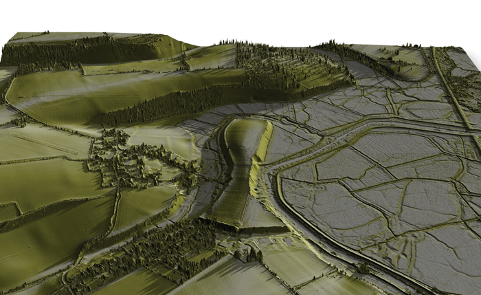
What motivated these works? Our current theory proposes a connection to the First Barons’ War, when rebellious noblemen invited French forces to invade, with a view to deposing King John and replacing him with Prince Louis, son of the ruler of France. The local link is provided by William d’Aubigny, 3rd Earl of Arundel, who was a favourite of King John before switching allegiance to Prince Louis (eventually returning to the royalist fold after the French army was defeated at Lincoln). Could d’Aubigny have ordered the burh’s refortification, or might villagers have done it under their own initiative in these turbulent times? Either way, it raises intriguing questions about the established narrative that Arundel Castle (founded c.1067) replaced Burpham as the major fortification guarding the Arun Valley. Might this instead suggest that the burh had been maintained after the Norman Conquest? We also shed light on the fortifications’ later life: once the 13th-century conflict had ended, it seems that the ditch was used as a rubbish dump, slowly filling with soil, broken pottery, and other unwanted items over the centuries. By the 1600s, and quite possibly earlier, it seems there were houses standing on level ground where once there was a deep, wide ditch.
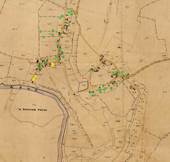
As mentioned above, the names of Wepham and Burpham both suggest early medieval origins, and following our excavations it does appear that both settlements were founded in the post-Roman period. Despite significant evidence of Roman-era activity within the wider parish, during the Big Dig we found a grand total of four pottery sherds and a single worn coin of this period. Instead, the earliest archaeological evidence of organised settlement that we identified emerged at Wepham, dating to either side of the Norman Conquest. Interestingly, more than 90% of the Saxo-Norman pottery excavated during the project came from three test-pits in Wepham, with very little seen in Burpham. This has led us to conclude that Wepham was the earlier of the two villages. Adding to this picture, the long, narrow, terraced gardens at Wepham may represent surviving burgage plots, again from around the Conquest period. Their original owners would have been able to grow their own food in exchange for maintaining fortifications, roads, and bridges – might the people of Wepham have been the original builders of the burh? If so, it seems that Burpham only began to grow as a village in its own right after the local church was built after 1066. Alternatively, its earliest phase could have been located inside the ramparts, though this raises the question as to why the settlement moved outside the earthworks at all.
This is an extract of an article that appeared in CA 440. Read on in the magazine, or click here to read it online at The Past, where you can read all of the Current Archaeology articles in full as well as the content of our other magazines, Current World Archaeology, Ancient Egypt, and Military History Matters.